– Advertisement –
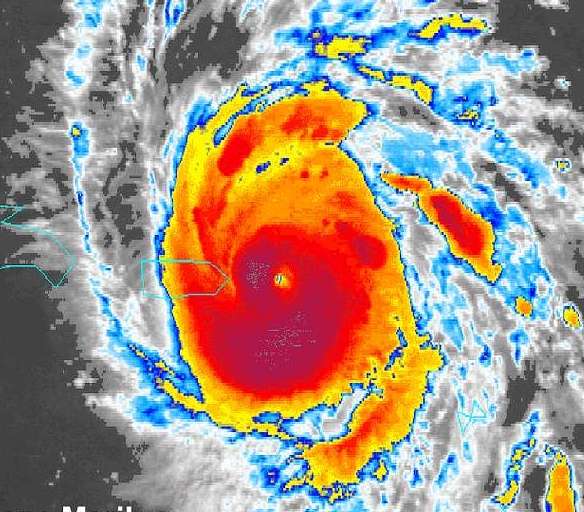
Meteorologist Jean Suriel says a weather disturbance over the Caribbean Sea could turn into a tropical depression or storm in the next day or two.
It is moving slowly west, south of Puerto Rico and the Dominican Republic. The system, called tropical wave number 48, has become more organized after crossing very warm waters, which increases the chance of it growing stronger. If it becomes a tropical storm, it will be named “Melissa.”
The disturbance is expected to pass about 200 to 400 kilometers south of Barahona, with its track becoming clearer between Tuesday and Wednesday.
Even if it does not become a storm, Suriel warns that the Dominican Republic will still feel its effects. The system’s clouds and winds will likely bring moderate to heavy rain starting Monday afternoon, especially in the east, southeast, south, Central Mountains, northeast, and near the border. The rain could get heavier on Tuesday with thunder and strong gusts, peaking on Wednesday.
If it strengthens and continues moving west or northwest, these areas could be affected:
Puerto Rico: May get rain and gusty winds on the southern and western coasts, especially if the system drifts slightly north.
The Virgin Islands: Could see scattered showers and rough seas.
Southern Haiti: Likely to receive rain and possibly strong winds, given its position close to the forecast path south of Barahona.
Jamaica and the Cayman Islands: If the system survives longer and continues westward, it could bring rain later in the week.
Eastern Caribbean (Lesser Antilles): These islands are already north and east of the system’s current position, so they are unlikely to face major impacts beyond rough seas and scattered showers.
Forecasters warn people to stay alert and follow official updates from the National Hurricane Center (NHC), the National Meteorological Office (ONAMET), and the Emergency Operations Center (COE) as flash floods and swollen rivers and ravines are possible in many places.
– Advertisement –


