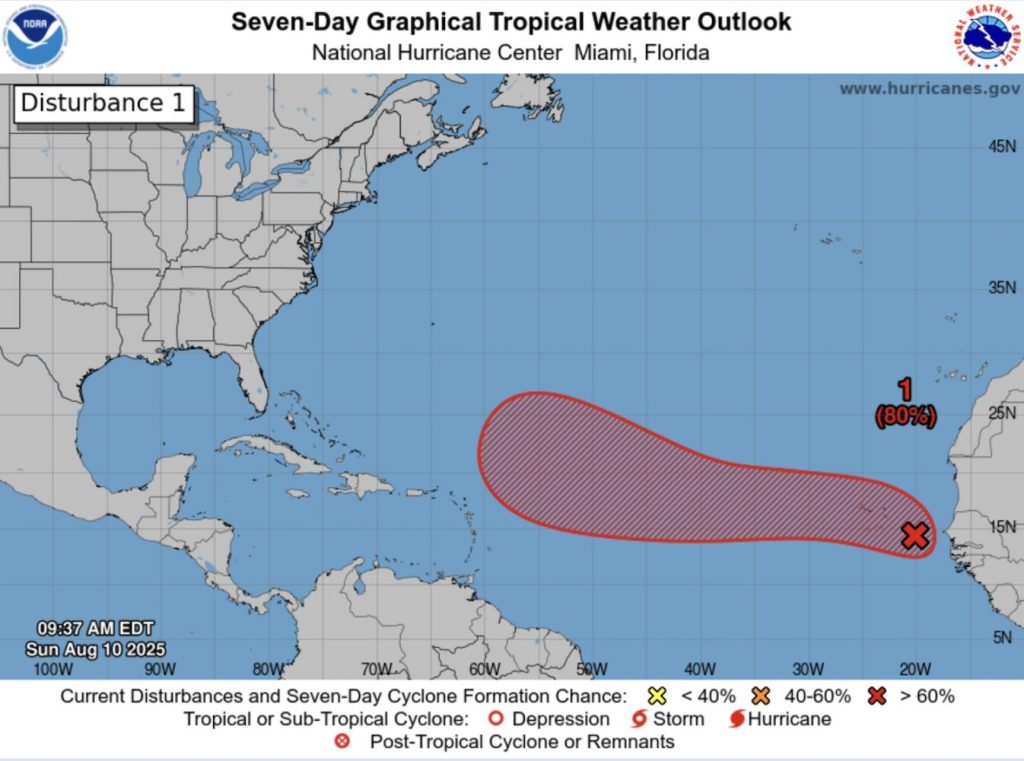
12pm, 10 August
A weather disturbance off the west coast of Africa has a high likelihood of developing into a tropical cyclone over the next seven days as it moves west.
Its path remains uncertain, though the latest National Hurricane Center forecast at 9.35am suggested Anguilla may be at the southern boundary of its projected route.
Weather experts from the centre said satellite-derived wind data had indicated that a low pressure system had formed with maximum winds of about 35 miles per hour.
At Anguilla Focus we keep our core content free for everyone – but our members get access to even more! Click here to join from just $3 per month.
“Although the associated shower and thunderstorm activity still lacks some organisation, only a small increase in the organisation could lead to the formation of a tropical depression,” it said.
The report said there is a 40% chance of this happening in the next 48 hours and an 80% probability in the next week.
“Even if a tropical depression does not form over the next day or so, environmental conditions appear conducive for later development,” it continued.
“A tropical depression is likely to form by the middle to latter portion of the week while moving west-northwestward at 15 to 20mph across the eastern and central tropical Atlantic.”
In May, the National Oceanic and Atmospheric Administration (NOAA) forecast increased storm risk this Atlantic hurricane season which runs from from June to November.
It predicted between 13 and 19 named cyclones with winds of 39 miles per hour or higher, with six to 10 forecast to become hurricanes with winds of 74 mph or higher.
Of those, the agency is expecting three to five to be major hurricanes, of category three, four or five, with winds of 111 mph or higher.
Information on how to prepare for a hurricane is available from the US National Weather Service here.
Visit the US National Hurricane Center for the latest updates on this and other weather disturbances at nhc.noaa.gov


