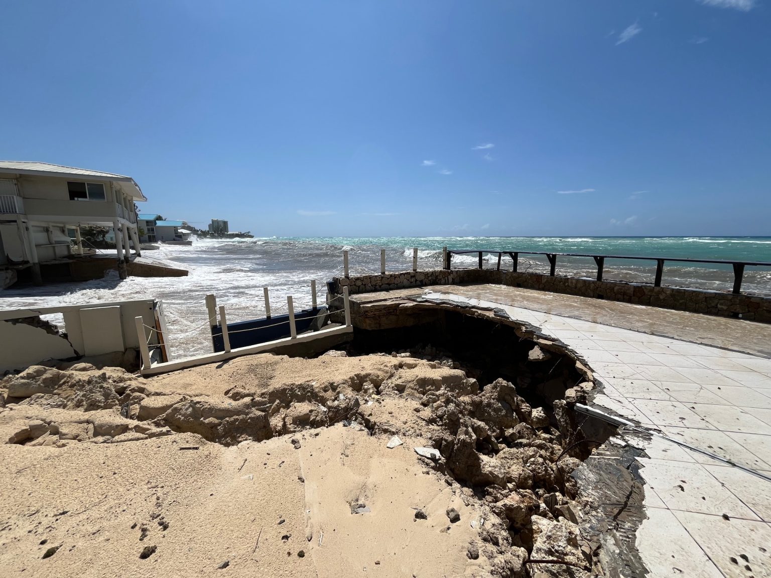
Photo: Simon Boxall
Hurricane Erin, which continues to churn its way through the Atlantic Ocean off the coast of the United States, serves as keen reminder that the centre of a large hurricane does not have to come close to a particular location to cause significant damage.
The first Atlantic hurricane of 2025, Erin is expected to be what is known as a ‘fish storm,’ meaning the centre of the hurricane will stay far away from land areas. That doesn’t mean the storm won’t pose a threat to any land masses, however.
This is something Cayman residents have learned in the past – and is the current reality for many residents of coastal North Carolina.
A very large wind field and waves emanating from Erin means coastal areas far from the centre of the storm will still see dangerous impacts.
A state of emergency has been declared for portions of coastal North Carolina and an evacuation order has been issued for Hatteras Island in anticipation of impacts from Hurricane Erin, even though the hurricane is expected to track at least 150 miles away from the Outer Banks.
The United States National Weather Service warned that life-threatening rip currents and dangerous surf would begin to impact parts of the US East Coast.
“Extensive beach erosion (is) likely due to strong long period wave energy with waves as high as 15 to 20+ feet in the surf zone,” the service said on Tuesday.
“Numerous roads will likely be impassable under several feet of water and vehicles will likely be submerged. Consider moving cars to higher ground.”
Cayman experience
People in the Cayman Islands know from firsthand experience that hurricanes don’t have to make landfall or even pass that close to land to cause life-threatening conditions.
On 25 Oct. 1998, Hurricane Mitch passed 190 miles south of Grand Cayman and despite the distance, the huge waves from the hurricane did extensive damage along the south coast. Parts of the west side of the island were also affected.
In an account of the impacts of Hurricane Mitch, Barbara Dailey recalled, “I went yesterday to check up on 2 friends at Mariner’s Cove. They had been pounded by the wind and waves and some condos had had their patio windows blown out by the force of the water and smashed to pieces. Their apartments have about 2″ of flood water with miscellaneous sea creatures, coral, pebbles, etc.”
Mariner’s Cove apartments were later completely destroyed in Hurricane Ivan in 2004.
Another example of a hurricane that passed a good distance away but still resulted in wave impacts was Hurricane Michelle in November 2001.
The Compass reported, “Although Michelle passed about 150 miles west of Grand Cayman, it caused some $28 million of damage, mostly from heavy surf along the west coast.”
On the 8 Oct. 2024, Hurricane Milton also brought large waves to the west side of Grand Cayman. The centre of that storm was located in the Gulf of Mexico, hundreds of miles north of the Cayman Islands.
“Large waves were crashing ashore on the west side of Grand Cayman, undermining part of the property and wall at Coral Beach on Seven Mile Beach … The waves and debris forced the closure of Seafarers Way between Warwick Drive and Fort Street to motorists,” the Compass reported at the time.
Experts have warned that climate change is causing hurricanes to get more powerful on average and also lead to rapid intensification that leaves little time to prepare for a more serve storm. In a 25-hour period between Friday 15 Aug. and Saturday 16 Aug., Erin went through an extraordinary intensification from a tropical storm to a Category 5 hurricane with 160mph winds. Such rapid intensification is something Accuweather hurricane expert Alex DaSilva warned about on 31 July when noting that a fairly quiet hurricane season was about to get busy in August.
Cayman Islands National Weather Service meteorologist Shamal Clarke said rapid intensification can mean faster-forming storm threats, even if the centre of a storm remains far away.
“In terms of swells from large tropical cyclones, given variables such as a large enough fetch, along with the size of the wind field associated with the storm, swells can be felt very far distances from the centre of a storm.”
He encouraged residents to remain prepared for the possibility of storm impacts, especially as hurricane season enters its peak period.
“Given the uncertainty regarding the strength and path a system could take, it is important to have a plan should the threat of a tropical cyclone become a reality,” he said.


