


Long before charts or compasses, the Caribbean was shaped by canoes, currents and memory.
The earliest peoples in the region moved slowly north out of the Orinoco and Amazon basins, following river mouths and trade winds into the Antilles. They carried cassava cuttings, cotton seed, thatch-working skills and a deep understanding of tides and seasons.
And at the geographical centre of that world, lay the islands and waters that would one day be called Cayman.
The first people
The first people that can be traced back to Cayman’s region in western Caribbean Sea, were the Ciboney, or Guanahatabey; quiet coastal foragers who settled western Cuba and the Isle of Pines (now Isla de la Juventud).
They lived almost invisibly: fishing, gathering shellfish, baking cassava on simple hearths, weaving thatch and sleeping in cotton hammocks strung between trees. No stone cities, no great plazas; just small bands moving with the shoreline and living almost entirely from the sea.
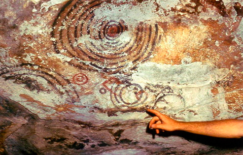
They left little evidence of their presence on the land’s surface; instead, their legacy endures in the artwork hidden in the caves. On the southeast side of the Isle of Pines, at sites such as Cueva Punta del Este, pictographs adorn the ceilings and walls of caves; most of the images appear to be concentric circles painted in red and black, that are believed to represent a type of primitive lunar calendar. Modest, almost private marks that speak of prayer, their relationship with the environment and survival.
Further along Cuba’s coast, in places like Cueva del Indio, similar rock art links caves, tides and ceremony.
For Cayman, the significance is geographical as much as spiritual: these are formal sacred sites sitting just over our northern horizon.
Taino communities
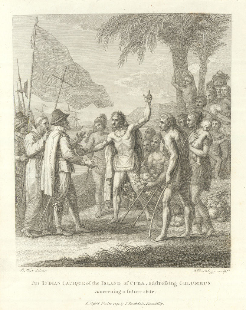
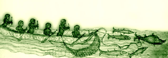
Centuries later a new wave arrived from the South American rivers; the Arawak / Taíno. They brought organised villages, cotton agriculture and a more structured spiritual life to the region. Across Cuba, Hispaniola and nearby Jamaica, they planted cassava fields, laid out ceremonial plazas and launched large dugout canoes capable of carrying dozens of paddlers.
Three of their words have never left us: hamaca (hammock), hurakán (hurricane) and canoa (canoe). The inventions were so perfect they were adopted instantly and the words travelled on into the Spanish and English languages almost unchanged.
Those same Taíno communities turned a native island cotton, Gossypium barbadense, into the world’s first true luxury fibre. Long-stapled, silky and cool in tropical air, it hung as hammocks, was knotted into fishing nets and wrapped around ceremonial figures.
Today we know it as sea island cotton, still marketed as one of the finest fabrics on Earth; but its story begins with indigenous planters scattered across the islands, including the wider region in the islands around Cayman.
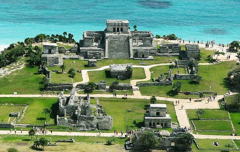
Around 600 miles to the west of the Cayman Islands, the temple pyramid of Tulum looks out on the turquoise water of the Caribbean Sea. Built around 1300 A.D., it marked the crossing to Cozumel, the sacred island of the moon goddess Ix Chel.
For centuries, trading canoes and pilgrim flotillas hugged that coast, using Tulum as a kind of stone lighthouse and trading area. The same currents that carried them along the Yucatán Channel flow on past Cuba and towards Cayman’s latitude, tying our ‘quiet sea’ into a much larger coastal highway.
Cayman lies within broad triangle of indigenous life
Southwest of the Cayman Islands, in the Bay Islands of Honduras, the small island of Barbareta has yielded some of the finest pre-Columbian objects ever found in the western Caribbean: polished stone celts, bird-headed effigies, ritual axes and carved figures.
Archaeologist William Strong argued that Barbareta was once a ceremonial hub, a kind of spiritual outpost facing the open sea. Many of its treasures now sit far away in climate-controlled drawers at the National Museum of the American Indian in New York.
Beyond Barbareta stretches the Miskito Coast of eastern Honduras and Nicaragua – a world of river mouths, hardwood groves and early forest-river societies. Their canoe routes linked the mainland to the Bay Islands and onwards along the edge of the Nicaraguan Rise. Long before the historic Miskito kingdom emerged, this coast supplied cacao, cotton, hardwood tools and spiritual traditions that flowed out across the same waters Caymanian seamen would later know as fishing and turtling grounds.
When you plot these sites on a map – Tulum and Cozumel to the west, Barbareta and the Bay Islands to the south and the Isle of Pines caves to the north – you see a broad triangle of Indigenous life. Cayman lies in that triangle. There is still no definitive archaeological evidence of permanent settlement here before Christopher Colombus, yet it seems unlikely that the canoe peoples who navigated this corridor were unaware of three low islands on their horizon.
Everything about Cayman would have appealed to them as a stopping place; calm waters on the leeward shorelines, rich turtle and conch grounds, pockets of soil where cassava could thrive and native plants that fitted neatly into their way of life; including our own Coccothrinax silver thatch palm.
Today, the carved stones of Barbareta rest in New York, the temple at Tulum faces crowds of tourists as it looks out on the Caribbean Sea and the Ciboney handprints in the Isle of Pines caves fade slowly in the damp air.